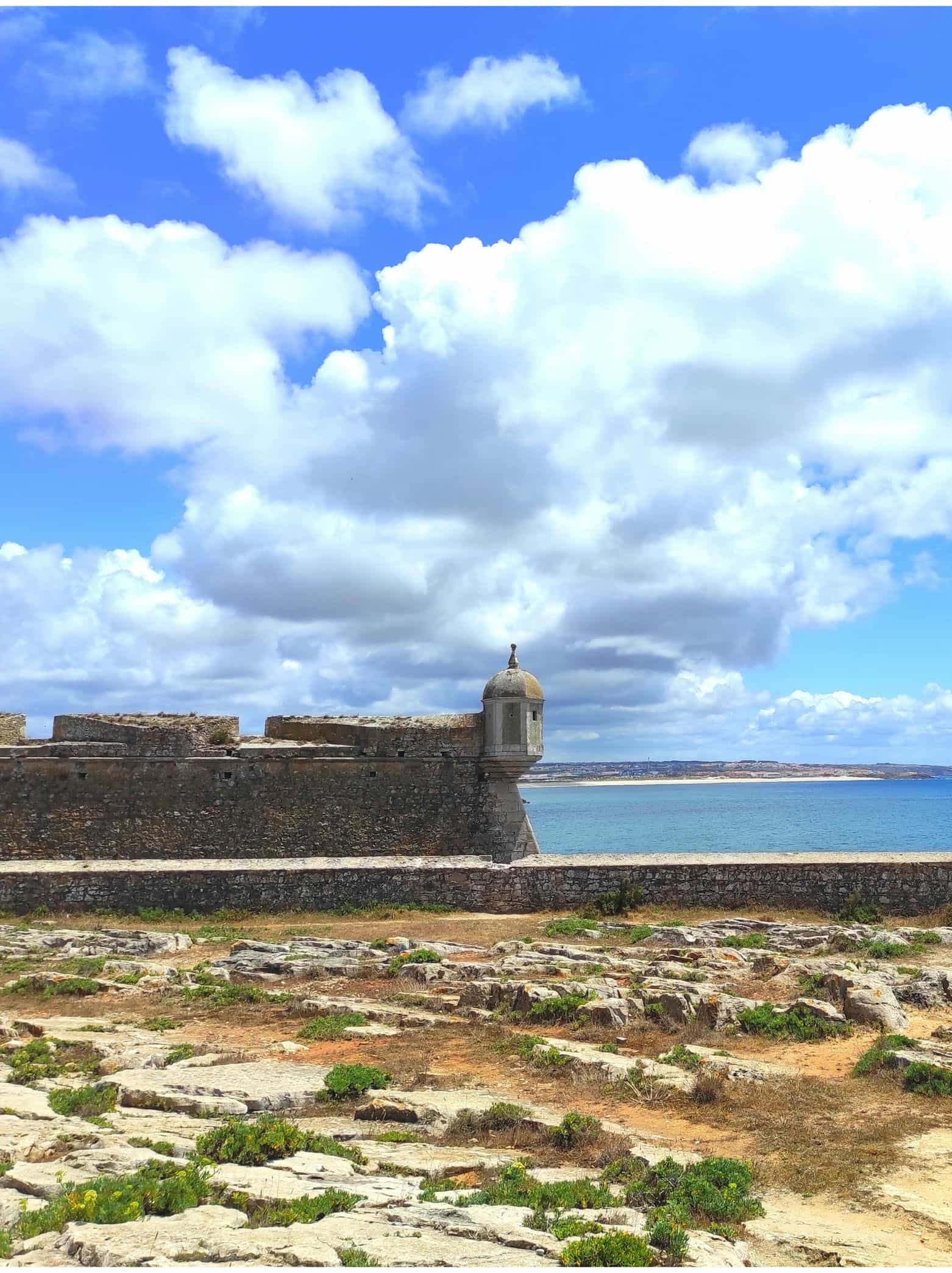
Heritage, Museums, Churches and Places of Interest

     Peniche, a town full of vestiges from 180 million years ago, centuries of remarkable history and occupied by various populations since prehistory. Having as its basis the fishing industry and agriculture until today, it was once the bottom of the ocean and today it is connected by an isthmus to the mainland, ceasing to be no longer an island and becoming a peninsula.

     Starting in the Early Jurassic, we find fossils as a mark of this period, limestone cliffs or a volcanic breccia. You can find places where there was presence of Neanderthal Man or with traces of the Roman era, such as Roman ovens.
     Monuments with centuries of history, many of them of great importance for the defense of Peniche and its population and also for Portugal. If you’re interested, you can visit the Churches and Chapels.
     Also very relevant for the survival of the population were the wells, walls and the entire surrounding area (the geographical location of the peninsula), as the sea (for the fishing activity) and all the terrain (fertile soils suitable for agricultural activity) that were the essential food resources.

     Peniche’s heritage doesn’t end here. We can’t finish without mentioning the ex-libris of the town, the Rendas de Bilros (Bobbin Lace), which are an unavoidable cultural heritage, recognized not only nationally, but internationally.

     And there is much more to see and discover in Peniche. You can find more detailed information here on our website.

     Bellow there’s a list with some of the places, monuments, museums and churches of great importance in the history of Peniche (from all over the county):

  • Berlengas Archipelago
  • Cabo Carvoeiro (Carvoeiro Cape)/Nau dos Corvos (Rock know as Ship of Crows)
  • Nossa Senhora da Guia Chapel
  • Nossa Senhora dos Remédios Chapel
  • Centro Interpretativo de Atouguia da Baleia
  • Santo Estêvão Chapel
  • Berlengas Lighthouse
  • Cabo Carvoeiro Lighthouse
  • Fonte do Rosário (Fountain/Well)
  • Fortaleza de Peniche (Peniche Fortress)/Museu Nacional Resistência e Liberdade (The National Museum of Resistance and Freedom – currently closed for improvements)
  • Forte da Consolação (Fort of Consolação)
  • Forte da Luz (Fort of Luz – ruins)
  • Forte de São João Batista (Fort of São João Batista)
  • Fortim do Baleal (Fort of Baleal – ruins)
  • Church of Misericórdia de Peniche
  • Nossa Senhora da Ajuda Church
  • Nossa Senhora da Conceição Church (Atouguia da Baleia)
  • Nossa Senhora da Conceição Church (Peniche)
  • Church of Sant’ana
  • São Leonardo Church
  • São Pedro Church
  • Sr. do Calvário Church
  • Cruz dos Remédios Viewpoint
  • Peniche City Walls and Gates
  • Museu da Renda de Bilros de Peniche (Museum of Bobbin Lace in Peniche)
  • Papôa (site of geological interest and place of a volcanic breccia)
  • Ponta do Trovão (site of geological interest)
  • Porto de Pesca (Fishing Port)
  • Prainha de São Pedro (São Pedro Beach – iconic place)
  • Ribeira Velha de Peniche (Marina)
  • Sítio Arqueológico da Rua Azeredo Perdigão (archeological site)
  • Sítio Arqueológico do Morraçal da Ajuda (archeological site)

     The Cabo Carvoeiro Lighthouse, located at the end of the peninsula, was built in addition to the existing church at the time, Igreja de Nossa Senhora da Vitória. It started functioning in 1790. It is one of the oldest on the Portuguese coast.
     In 1886 it was completely rebuilt, with a tower 26.80 meters high and na altitude of 56.80 meters. Its optical device has suffered several changes during these centuries, maintaining its red light. If you don’t know why it’s red, we’ll explain. The lighthouses that are on the right of a port are red and those on the left are green. The light of this lighthouse has a range of 15 miles with an interval of 2 seconds on and 4 seconds off.
     The main purposes of a lighthouse are to serve as a navigational aid and to warn boats of dangerous areas, being divided in coast lighthouses and port lighthouses.
     Fun fact: no lighthouse can look the same as another, nor can it have the same luminous period.
     For more information, consult the website of the Autoridade Marítima Nacional (National Maritime Authority), in amn.pt .

    Fortress

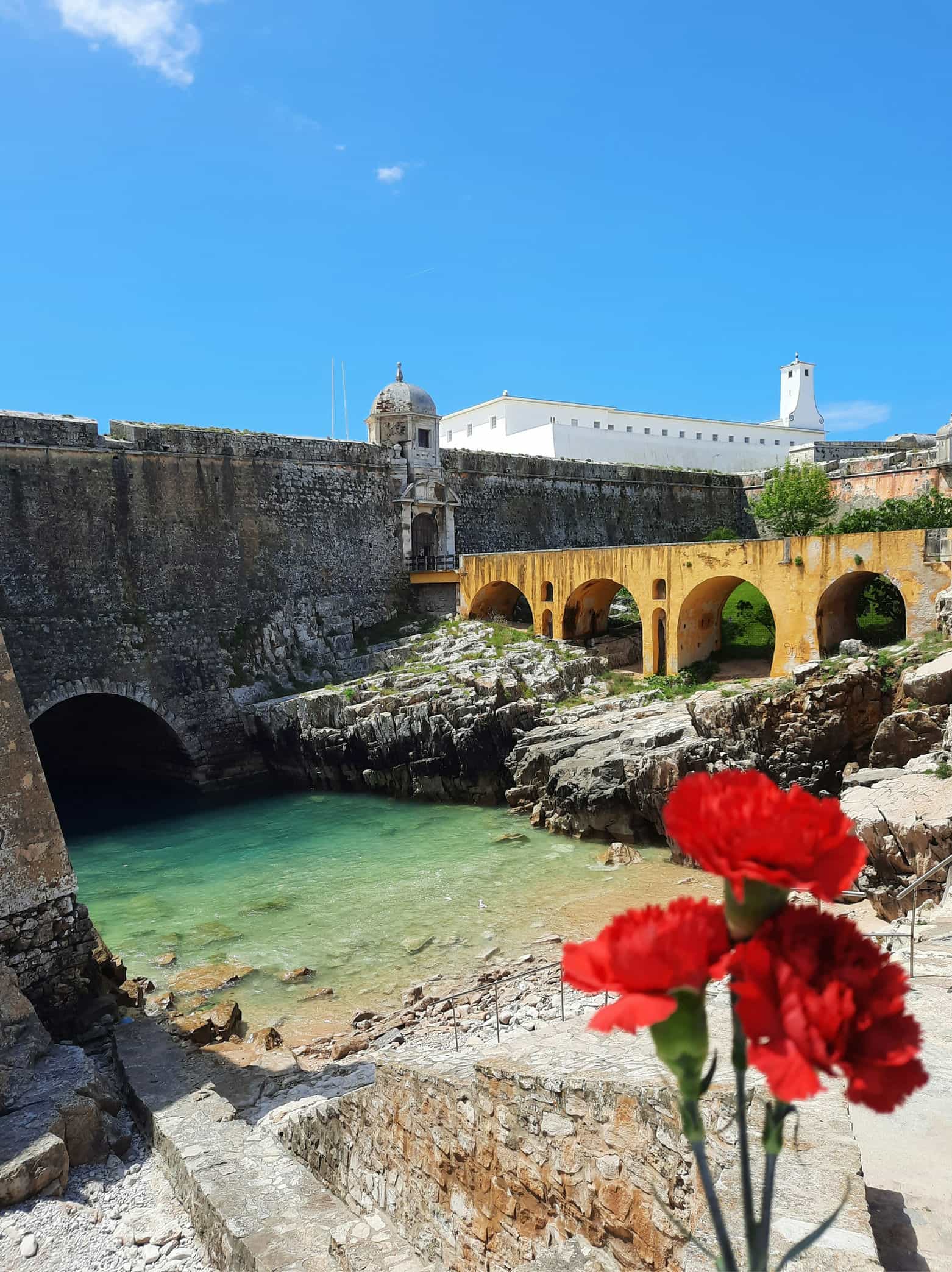
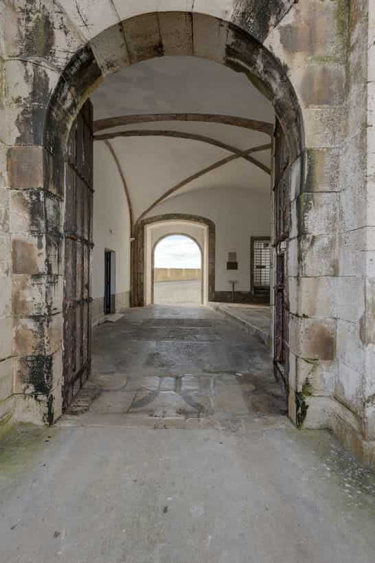
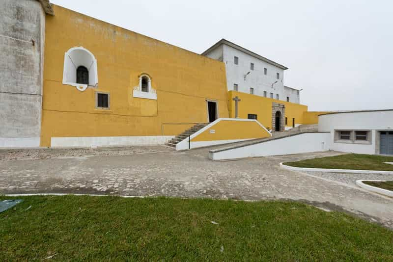
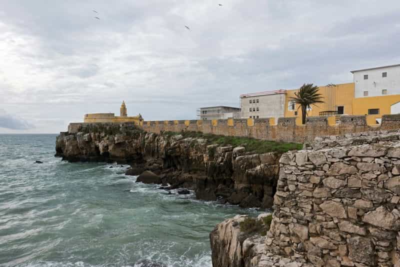
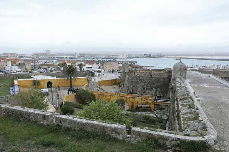
     The Peniche Fortress has a bastioned layout corresponding to the town’s citadel and war square.
     In 1557, began the construction of the fortification of Peniche. D. João III orders D. Luís de Ataíde to build a bastion, with its tower, on the Alto da Vela site.
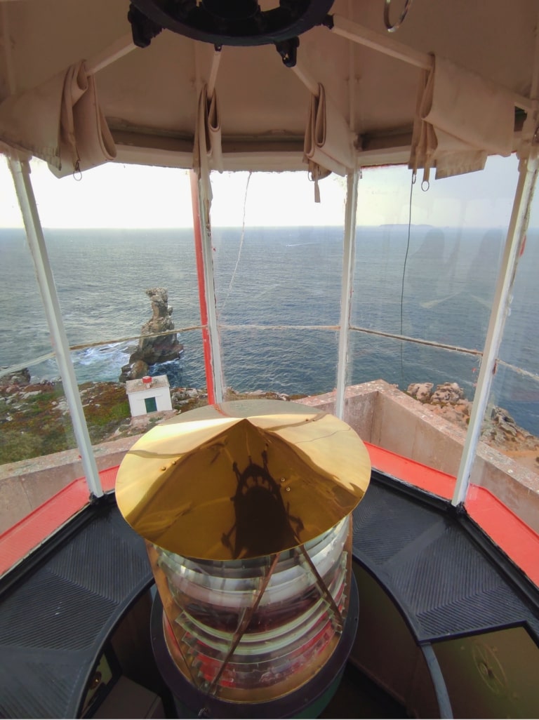
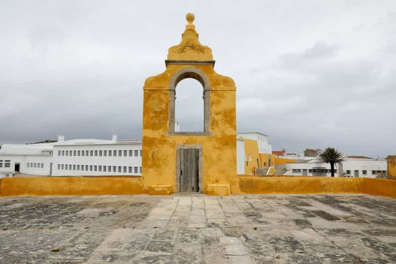
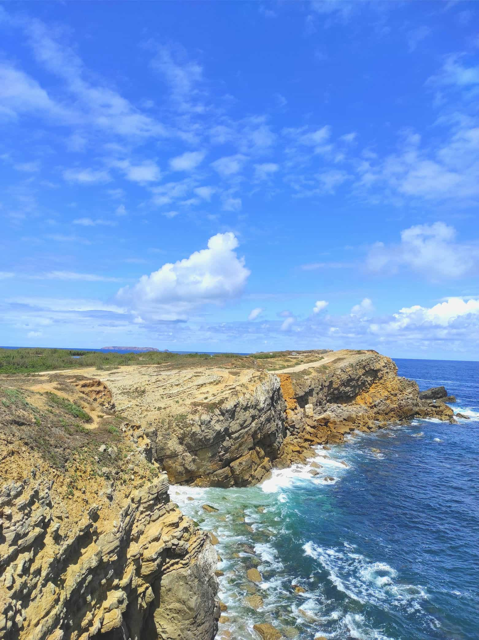
     In 1671, the construction work of the walled cloth of the military square was concluded, according to the inscription on the Baluarte Redondo (the small yellow fort you can see on photos 17 and 18), which was originally exposed in the Forte das Cabanas (photo 24).

    Prison

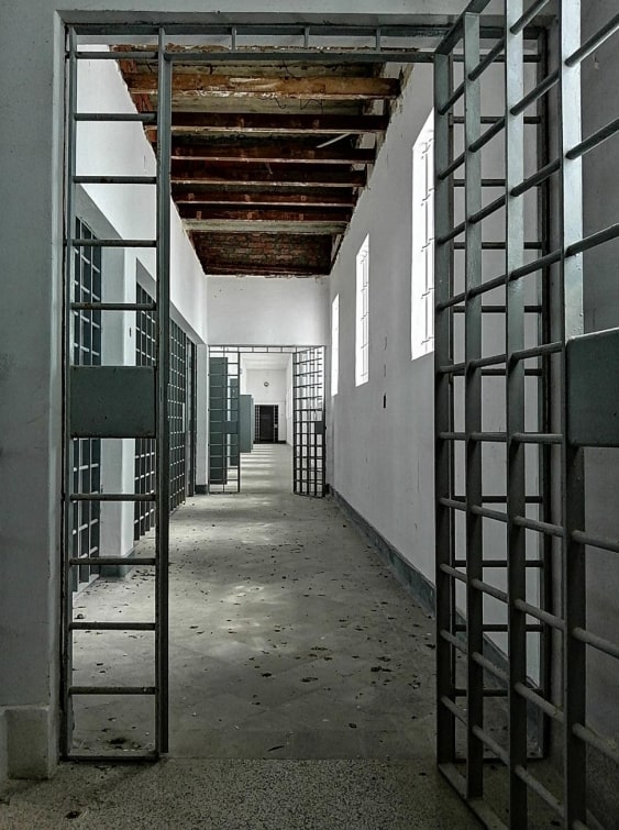
     In 1934, the Depósito de Presos de Peniche (Prisoners Deposit of Peniche) was installed in the Fortress, intended for opponents of the Estado Novo regime.
     The works for the construction of a new prison began in 1954. This new prison consists of 3 prison blocks built according to the North American model. The Peniche Fort Chain is born.
     April 27, 1974 happens the Liberation of political prisoners after the triumph of the Revolução dos Cravos (Carnation Revolution).

    Museum

     The Government of Portugal, meeting in the Council of Ministers at the Peniche Fortress on April 27, 2017, determines the creation of the National Museum of Resistance and Freedom in this place.
     The MNRL (Museu Nacional Resistência e Liberdade – National Museum of Resistance and Freedom) was born from the recognition of the Peniche Fortress as a space-memory and major symbol of the struggle for freedom on a national scale, with international resonances in the ancestral and current struggle for Democracy and respect for Human Rights.
     With a multidisciplinary scope, the Museum’s mission is to investigate, preserve and communicate the national memory related to the Resistance to the Portuguese fascist regime, based on the memories and experiences of those who fought for Freedom and Democracy.
     Currently the MNRL and Fortaleza are closed for reconstruction and remodeling. The forecast for opening of the Fortress points to 2023 and the Museum to 2024. You can find more information on the MNRL website.

     It is said that the image of Nossa Senhora (Our Lady) was found in a small cave in the 12th century. This cave was located in the place where the chapel is now built.
     At that time, after the discovery of the image, the religious worship of the designated Nossa Senhora dos Remédios began. This cult turned out to be important with the constant pilgrimages and the Círios (a religious ceremony), leading to the construction of the sanctuary in the 17th century.

     This small church from the beginning of the 17th century was built attached to the old hospital of Santa Casa da Misericórdia de Peniche.
     Inside it is possible to admire all the ostentatious decoration, from the 17th century panels, to oil paintings and coffers, which decorate the ceiling.
     This small church has a particularity that distinguishes it from the rest of the city – the clock tower, built in 1697.

     Built on the ruins of another church (at the time, Church of São Vicente), in the 16th century, the origin of this church is legendary.
     It is said that, in a small cave in Papôa, the image of the Virgin was found by fishermen, whose image became the target of devotion. After this event began the construction of the Church in her honor.

     Located in the historical center of the Peninsula, the construction of the largest church in Peniche began at the end of the 16th century, taking 100 years to be built. It was devoted to São Pedro (main altar) and to Nossa Senhora da Boa Viagem (known as the patron saint of fishermen), to Sr. Do Bonfim and S. Pedro de Alcântara (side altars).
     The construction of the front panel of the church is unfinished, with one of the towers remaining to be built.
     For centuries, the church guided navigators, as the tower served as a guide to fishermen’s vessels, helping them to find the port of Peniche for their safety.

Sites of geological and archaeological interest

     Did you know that there is a volcanic breccia in this area?
     In this place it is possible to admire rock formations from the Lower Jurassic, starting by white layers of limestone, then followed by basaltic vulcanic rocks that are in greenish grey tones which are now of an orange color (due to the oxidation).Also visible are the pink granites like the ones that can be found in Berlengas and the limestones in white tones, similar to the limestones found in Cesaredas or others places in Peniche.
     In this region, in the 18th century, a shipwreck occurred on the north side of Papôa. Soon you’ll be able to find more about this incident in the “Stories and Legends” section, in “Discover Peniche”.
     At Papôa there is also a geodesic point. A geodesic point is a signal that indicates an exact cartographic position and that forms part of a triangulation network with other geodesic point.

     Did you know that this geosite was recognized, in 2016, with a Golden Spike?
Ponta do Trovão is very important from the geological time aspect. This geosite (site of geological interest) determines the tansition from the Pliensbachian stage to the Toarcian stage (about 182,7 millions of years ago).
     Beside being a geosite, is also a site of archeological interest.
     This place was also the adress of a chapel, Ermida de Nossa Senhora do Abalo (also know as the Capela de Bom Jesus do Abalo). This small chapel, from the 16th century, was built in order to keep an altar piece that would’ve washed ashore due to a shipwreck.
     Due to the fragile location and the constant erosion, the chapel started to decay, being abandoned later on due to the abolition of the Religious Orders, in 1834.
     The altar piece is today in Santa Casa da Misericórdia and all that is left from the chapel are the remains, covered by herbs.

     This is one of the most iconic places of Peniche. Its great geological attributes turn this place into a target of huge demand and it is even more demanded when it’s time to see another day end. Nobody who admires the sunset over the Berlengas archipelago in Cabo Carvoeiro stays indifferent. It is one of the most beautiful places for a late afternoon.
     Nau dos Corvos (Ship of Crows), close to the cape, is a rock similar to a boat, inhabited mainly by Corvos Marinhos/Galhetas (cormorants). This rock is also one of the symbols of the city.
     Whoever crosses this Cape is sure to find a more challenging ocean. The southern part of the peninsula is usually more serene.
     Two interesting facts: some people say that Cabo Carvoeiro is the most westerly point of the continental Europe and also here begins the Estrada Nacional 114 (National Route 114) that passes through the districts of Leiria and Santarém, ending in Évora.

     In this cave prehistoric records were found. It was used used as shelter or necropolis. Marks left by Homo Sapiens and Homo Sapiens Sapiens (modern human beings), vestiges of fauna from the Quaternary period (fish and mammals), utensils made of bones, lithic utensils (arrowheads, bifaces, axes) and several pieces of Neolithic ceramics. These were found here by the archaeologist from the 19th century, Nery Delgado.

     Over the Atlantic, we catch a glimpse of the Berlengas Natural Reserve (designated as Berlengas Biosphere Reserve by UNESCO). It’s an uniquely beautiful archipelago, with its caves, animals and all the surrounding nature. At the top of Berlenga Grande we can find the lighthouse, an elevated structure whose functions are to serve as a navigational aid and to warn boats of dangerous areas. And half hidden, between the cliffs of the island, we can find the Forte de São João Batista, inaugurated in 1502. Find more info about the Berlengas here.

RESERVE AGORA RESERVE AGORA